Clipart
Free Clipart. Over 100,000 clipart, pictures, illustrations, icons, photographs and images to download.

Map of North Africa
rohan.sdsu.edu/home/lukinbea/northafric...
Map of Israel, Jordan, the West Bank, and the Gaza Strip - World Sites Atlas
A political map showing major cities and towns.
sitesatlas.com/Maps/Maps/603.htm
http://www.indstate.edu/gga/gga_cart/basenc.gif
Black and white map of North Carolina.
indstate.edu/gga/gga_cart/basenc.gif
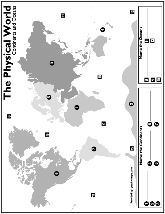
Name The Continent Map
Printable map, which students can name the continents.
graphicmaps.com/webimage/testmaps/namec...
Map of Morocco, the Canary Islands, the Azores, and Madeira - World Sites Atlas
A political map showing major cities and towns.
sitesatlas.com/Maps/Maps/701.htm
Map of Northern Hemisphere
eduplace.com/ss/ssmaps/northhemi.html
Map of Northwest Territories and Yukon Territory
A political map showing major cities and towns.
sitesatlas.com/Maps/Maps/207.htm
Printable Map of the US - Southeast Region
Outline map of the South East area of the US.
scottforesman.com/educators/maps/SEmap....
http://www.indstate.edu/gga/gga_cart/basema.gif
Black and white outline map of Massachusetts.
indstate.edu/gga/gga_cart/basema.gif
Graphic Map's South American Continent outline map
graphicmaps.com/webimage/countrys/samer...
Southest Asia: Political
A political map of Southeast Asia.
eduplace.com/ss/ssmaps/seasia.html
Map of the Czech Republic, Hungary, and Slovakia - World Sites Atlas
A political map showing major cities and towns.
sitesatlas.com/Maps/Maps/516.htm
Map of Yugoslavia - World Sites Atlas
A political map showing major cities and towns.
sitesatlas.com/Maps/Maps/522.htm
United States
Black and white map of the United States, includes state labels.
eduplace.com/ss/ssmaps/usa_postal.html
Map of Manitoba and Saskatchewan - World Sites Atlas
A political map showing major cities and towns.
sitesatlas.com/Maps/Maps/204.htm
World Atlas: Interactive Physical Map - World Sites Atlas
This on-line world atlas includes matching political and relief maps featuring over 4000 place names.
sitesatlas.com/Atlas/PhysAtlas/index.ht...
Previous Next
rohan.sdsu.edu/home/lukinbea/northafric...
Map of Israel, Jordan, the West Bank, and the Gaza Strip - World Sites Atlas
A political map showing major cities and towns.
sitesatlas.com/Maps/Maps/603.htm
http://www.indstate.edu/gga/gga_cart/basenc.gif
Black and white map of North Carolina.
indstate.edu/gga/gga_cart/basenc.gif
Name The Continent Map
Printable map, which students can name the continents.
graphicmaps.com/webimage/testmaps/namec...
Map of Morocco, the Canary Islands, the Azores, and Madeira - World Sites Atlas
A political map showing major cities and towns.
sitesatlas.com/Maps/Maps/701.htm
Map of Northern Hemisphere
eduplace.com/ss/ssmaps/northhemi.html
Map of Northwest Territories and Yukon Territory
A political map showing major cities and towns.
sitesatlas.com/Maps/Maps/207.htm
Printable Map of the US - Southeast Region
Outline map of the South East area of the US.
scottforesman.com/educators/maps/SEmap....
http://www.indstate.edu/gga/gga_cart/basema.gif
Black and white outline map of Massachusetts.
indstate.edu/gga/gga_cart/basema.gif
Graphic Map's South American Continent outline map
graphicmaps.com/webimage/countrys/samer...
Southest Asia: Political
A political map of Southeast Asia.
eduplace.com/ss/ssmaps/seasia.html
Map of the Czech Republic, Hungary, and Slovakia - World Sites Atlas
A political map showing major cities and towns.
sitesatlas.com/Maps/Maps/516.htm
Map of Yugoslavia - World Sites Atlas
A political map showing major cities and towns.
sitesatlas.com/Maps/Maps/522.htm
United States
Black and white map of the United States, includes state labels.
eduplace.com/ss/ssmaps/usa_postal.html
Map of Manitoba and Saskatchewan - World Sites Atlas
A political map showing major cities and towns.
sitesatlas.com/Maps/Maps/204.htm
World Atlas: Interactive Physical Map - World Sites Atlas
This on-line world atlas includes matching political and relief maps featuring over 4000 place names.
sitesatlas.com/Atlas/PhysAtlas/index.ht...
Previous Next