
US States Learning Topics:
- Alabama
- Alaska
- Arizona
- Arkansas
- California
- Colorado
- Connecticut
- Delaware
- Florida
- Georgia
- Hawaii
- Idaho
- Illinois
- Indiana
- Iowa
- Kansas
- Kentucky
- Louisiana
- Maine
- Maryland
- Massachusetts
- Michigan
- Minnesota
- Mississippi
- Missouri
- Montana
- Nebraska
- Nevada
- New Hampshire
- New Jersey
- New Mexico
- New York
- North Carolina
- North Dakota
- Ohio
- Oklahoma
- Oregon
- Pennsylvania
- Rhode Island
- South Carolina
- South Dakota
- Tennessee
- Texas
- Utah
- Vermont
- Virginia
- Washington
- West Virginia
- Wisconsin
- Wyoming
internet resources
Clipart for Each US State
Listing of clipart for each of the states. Includes, birds, flowers, maps, important people
classroomclipart.com/clipart/Clipart/States...
United States Flag Clipart
Flag Clipart for each of the of US States
classroomclipart.com/clipart/Clipart/State_...
US State Maps Clipart
Maps for each of the states. Includes black and white map clipart and colorful map clipart.
classroomclipart.com/clipart/Clipart/Maps/U...
Place the State Game
Place the State correctly on the map
http://https://bensguide.gpo.gov/states5/
Local Government on the Net: Oklahoma
A frequently updated directory of official Oklahoma state and local government sites. Includes links to cities, counties, and state agencies in Oklahoma.
Washington State and Local Government
Color Landform Atlas: U.S. Links
fermi.jhuapl.edu/states/us_links.html
We Shall Overcome -- Little Rock Central High School
Photographs and description of the Little Rock Central High School
cr.nps.gov/nr/travel/civilrights/ak1.ht...
Road map of Louisiana - World Sites Atlas
A road map showing interstate and U.S. highways as well as major cities and towns.
sitesatlas.com/Maps/Maps/119.htm
http://www.graphicmaps.com/webimage/testmaps/usstates.gif
Name the state handout and printable map.
Name the State Map
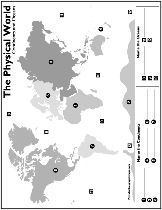
Name The Continent Map
Printable map, which students can name the continents.
graphicmaps.com/webimage/testmaps/namec...
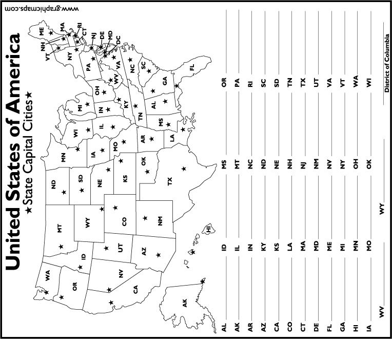
Map of the United States - Name the State
A printable map. Students can name the State Capitals.
graphicmaps.com/webimage/testmaps/uscap...
United States Weather
This page provides easy access to dozens of weather products specific to United States. Conditions, forecasts, warnings, radar, climate information, satellite photos, and much more.
weather.gov/
Banknotes.com - Banknotes of United States of America
You will find pictures of banknotes from the United States along with country specific info.
banknotes.com/us.htm
Pictures of National Parks
View a photo gallery featuring more than 2500 captioned pictures covering each of the 57 US National Parks
terragalleria.com/parks/
America's Roof Guide to the Highest Points
Maps, Trip Reports, Theatre, VRML for the highest mountains in the United States and the world.
americasroof.com/
The Osage Tribe's Official Homepage
This is the Official Osage Tribe's WebSite...Sponsored fully by the Osage Tribal Council
osagetribe.com/index.htm
Next